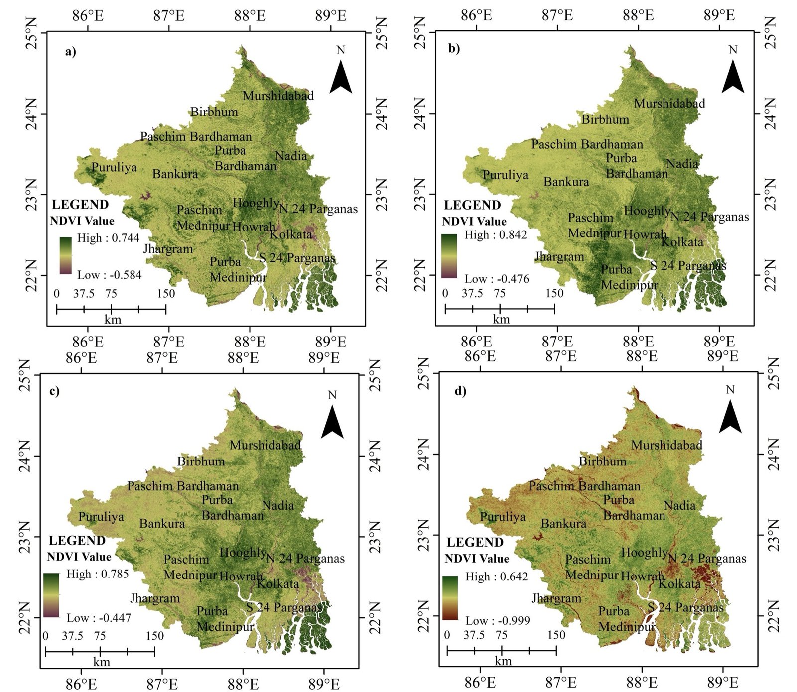
01 / 13NDVI · southern West Bengal, four dates
Code · Cloud · AI
Work with spatial data through programming, cloud computing, statistical modelling and automation.
The leading language for RS, GIS and geospatial data science — automation, analysis, ML and apps.
Advanced statistics, spatial modelling, predictive analytics and scientific visualisation.
Planet-scale analysis from the browser on Google’s cloud.
Desktop GIS, spatial databases, automation and collaborative development.
PostgreSQL/PostGIS, spatial SQL, indexing, optimisation and geodatabase management.
GeoServer, Leaflet, OpenLayers, MapLibre GL and cloud hosting.
Imagery + field surveys + GIS + ML + visualisation + web publishing.
A friendly, hands-on introduction to satellites, sensors, coordinate systems and your first maps in QGIS.
Automate vector and raster workflows with GeoPandas, Rasterio and GDAL — and never click through the same task twice.
Analyse decades of Landsat and Sentinel imagery in the cloud — time series, composites and land-cover classification.