Census atlas · Bankura District
Thematic maps from the Geospatial Research Laboratory — a census atlas of the 22 community development blocks of Bankura District, West Bengal, from 1991 to 2011.
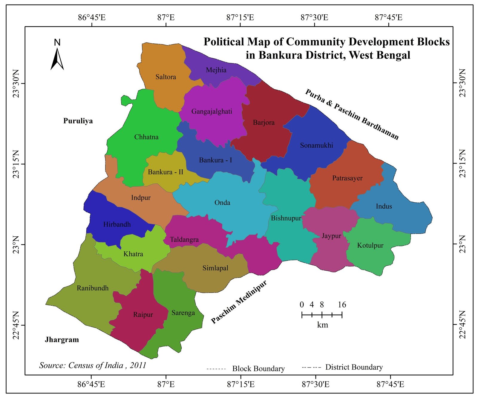
Bankura lies on the western edge of the Bengal basin, between Puruliya to the west, Purba and Paschim Bardhaman to the north and north-east, Paschim Medinipur to the south-east and Jhargram to the south-west. It is administered through 22 community development (C.D.) blocks.
The maps below bring together block-level figures from the Census of India 1991, 2001 and 2011 to show how many people live in each block, how densely, in how many rural households, and in what social composition. Each map was prepared at the laboratory with standard cartographic techniques: choropleth shading, proportional diagrams, dot density and pie-chart symbols.
Select a map to view it. Each one opens at full resolution for study or citation.
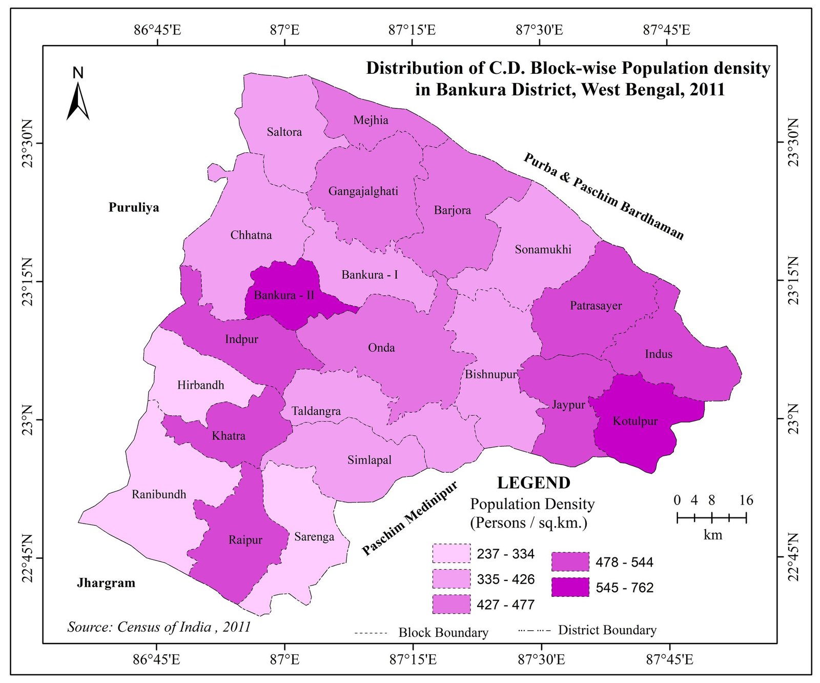
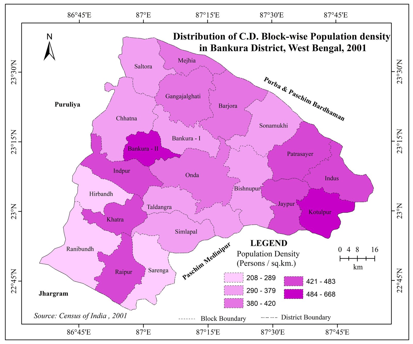
Population density shaded in five classes, so the same block can be compared between censuses.
Three bars per block, one per census, show the growth in total population from 1991 to 2011.
Each dot stands for 300 rural households, revealing where settlement concentrates within each block.
Scheduled Tribe, Scheduled Caste and general population shares, drawn for every block.
We help students and scholars plan, prepare and publish thematic maps for their study areas.